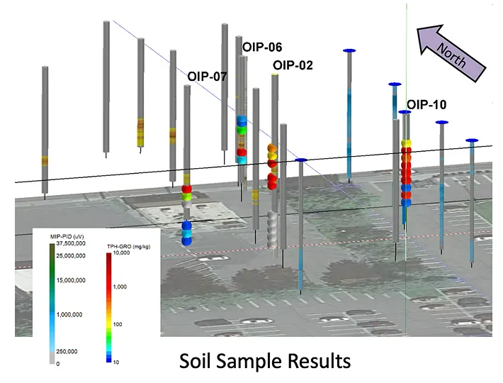
High-Res Site Characterization
COLUMBIA performs High-Resolution Site Characterization (HRSC) using multiple lines of evidence including direct sensing tools and techniques, plus its SmartData Solutions® platform, to detect and map the locations of subsurface contamination, track soil and groundwater changes, and evaluate existing remediation systems. Our approach to HRSC is rigorous and proven:
- We deploy experienced geochemists with deep backgrounds in environmental science and data analysis to oversee the workplan.
- We communicate our findings frequently to stakeholders as the project progresses.
- We are highly flexible, employing an Adaptive Site Management Plan, adjusted in real-time based on what we learn about the toxins found in the soil and groundwater and the performance of remediation activities.
- We leverage HRSC data to inform the financial, operational, and risk management plans for the long-term risk management and cleanup of the site.
- We use a variety of direct sensing and analytics tools to ensure that we can create an accurate, high-resolution description of a site, including:
- High-resolution analyses of the soil, groundwater, and vapor conditions driven by direct sensing technologies.
- Remote sensing, including satellite and UAV surveys of remote sites.
- Statistical sampling and screening of soil, groundwater, and vapor conditions
- Measurement of geochemical conditions.
- Measurement of microbial population.
- Real-time SmartData Solutions® platform outputs, including a complete dataset and a detailed 3D conceptual site model.
The key deliverable from the Site Characterization phase is an interpretive technical report, which describes the procedures, field records, observations and analysis, professional interpretation, 3D model with cross-sections, conclusions, and recommendations. Key data elements include:

- High-resolution direct imaging to identify and isolate residual source mass and soil conditions and likely pathways for the migration of contaminated groundwater or vapors.
- High-resolution analyses of the soil within the residual source zones to identify the individual organic hydrocarbons and quantify the mass and volume of contamination requiring treatment.
- A detailed 3D conceptual site model to support the selection of remediation technologies and techniques.
- Selected sampling and analysis of groundwater to determine the impact of contamination to inform the selection of remediation technologies and manage long-term risk.
- Statistical sampling and screening of soil for metal or inorganic contamination to look for non-compliance with standards for land reuse.
- Measurement of the microbial population to support bioremediation and manage long-term risk.
